
CH-VD-02
Chabrey | Pointe de Montbec I
Short Description
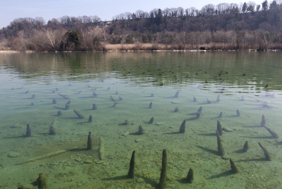
Pointe de Montbec extends to about 1.8 hectars and represents one of the largest prehistoric sites at the Neuenburgersee. The settlement remains are submerged in 1-3 meters of water, and one can easily recognize their architectural layout, with a system of rectangular Palisades for protection. In the assembled map, we can recognize three-sectioned buildings that stand perpendicular to the shore, and we can identify at least two construction phases. The site is located in an undeveloped area of the lake, but the erosion of the shoreline is considerable, and needs to be monitored. Northeasterly of the village, four log boats were recovered.
More information is available at the Historisches Lexikon der Schweiz

Bronze Age
Late Bronze Age, approx. 1050-960 B.C.
Lake Neuchâtel
427 m.a.s.l.
Size of the site 1,78 ha / approx. 2-3 soccer pitches
Size of the bufferzone 7,18 ha / approx. 10 soccer pitches
Special Features & Highlights
During the Jurassic shoreline modifications of the lakes, between 1869 and 1891, it was discovered that the site of Montbec I extended further into the shore than previously known. Unfortunately, the erosion caused by the prevalent north-easterly storms has swept away part of the settlement.

Pile Dwelling up close
The archaeological artifacts that were recovered from the sites of the Neuenburgersee in the Canton of Waadt are exhibited in the Cantonal Museum for Archaeology and History in Lausanne.
Musée cantonal d'archéologie et d'histoire
Palais de Rumine
Place de la Riponne 6
1005 Lausanne
+41 21 316 34 30
to the website